The Land Where Faith Took Root: Understanding Biblical Geography
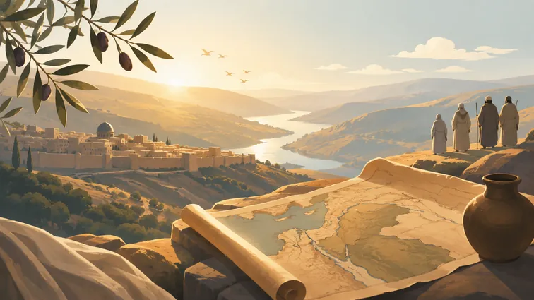
Ever wondered what the Holy Land actually looked like when Moses led the Israelites through the wilderness or when Jesus walked the shores of Galilee? Biblical geography isn't just about memorizing place names on a map. The geography of the Holy Land had a profound impact on the biblical narrative, influencing events, culture, and spirituality.
"Enter the Holy Land which Allah has destined for you ˹to enter˺. And do not turn back or else you will become losers."
Quran 5:21 (referencing Moses)
The Shape of the Promised Land
The Holy Land is traditionally synonymous with what is known as the Land of Israel (Zion) or the Promised Land in a biblical or religious context, or as Canaan or Palestine in a secular or geographic context - referring to a region that is mostly between the Mediterranean Sea and the Jordan River. But here's what's fascinating: The Hebrew Bible provides three specific sets of borders for the "Promised Land", each with a different purpose.
The biblical boundaries weren't fixed like modern nations. The common biblical phrase used to refer to the territories actually settled by the Israelites (as opposed to military conquests) is "from Dan to Beersheba" (or its variant "from Beersheba to Dan"), which occurs many times in the Bible. This phrase gives us a snapshot of the land's north-south span, roughly 150 miles.
A Land of Dramatic Contrasts
What strikes you first about biblical geography is how much variety gets packed into such a small space. From north to south the land of Canaan is roughly the size of New Jersey. Yet within this compact area, you'd find incredible diversity.
The geographical contrasts of the Holy Land are truly stunning. The region spanned from the snow-capped peak of Mount Hermon (over 9,000 feet) to the Dead Sea, the lowest point on earth at roughly 1,300 feet below sea level.
Geography Fact
Modern Israel is 353 times smaller than Australia and would fit into Tasmania 3.3 times. Yet this tiny area contains Mediterranean coastlands, mountain ranges, fertile valleys, and desert wilderness.
Think about what this means for the biblical story. The Holy Land is a land of contrasts.
It has an ocean coast (Mediterranean Sea), a small river (Jordan River), rich agricultural land (coastal plain and the Jezreel Valley in Galilee) and semiarid expanses (southern regions around Beersheba known as the Negev).
The Central Highlands: Heart of Israel's Story
The highlands consist of Galilee in the north and the West Bank in the center, also known as Samaria and Judea. The central highlands were the traditional area of Israelite settlement in the Iron Age, with the more southerly Judean hills anchored by the city of Jerusalem.
This wasn't accidental. The areas of Galilee and the Mediterranean coast were occupied by the Canaanites and the Philistines when Israel's ancestors came into the land from Mesopotamia at the time of Abraham (circa 1800 B.C.) and from Egypt at the time of Moses (circa 1250 B.C.) Therefore, the Israelites settled in the central hill country to the north and south of Jerusalem.
| Region | Biblical Significance | Modern Location |
|---|---|---|
| Galilee | Jesus' ministry center | Northern Israel |
| Judea | Jerusalem, David's kingdom | West Bank hills |
| Samaria | Northern kingdom capital | Central highlands |
Water Sources: Rivers of Life and Faith
Water shaped everything in the ancient Middle East. In the Holy Land, the Jordan River is the most significant water feature, playing a central role in biblical narratives. The Jordan River: Known for its role in the baptism of Jesus and as a boundary between the tribes of Israel (Joshua 3:14-17, Matthew 3:13-17).
The Jordan's journey tells its own story. The Jordan river is fed by the melting snow from Mt Hermon and the surrounding hills, it runs through Lake Galilee and on to the Dead Sea. This river system created a natural north-south corridor that influenced trade, settlement, and military campaigns throughout biblical history.
Key Geographic Features
- Sea of Galilee: 21km long, 11km wide, lowest freshwater lake in the world
- Jordan River: Connects Sea of Galilee to Dead Sea via natural rift valley
- Dead Sea: Earth's lowest land point, extremely salty
- Mediterranean Coast: Major trade routes and fertile plains
How Geography Shaped Biblical Events
Location mattered enormously in biblical times. The diverse geography of the Holy Land influenced the course of biblical events. For example, the mountainous terrain often dictated the paths of travelers and armies, while the availability of water sources determined the locations of settlements.
Consider Jesus' ministry strategy. Why did Jesus focus so much on towns like Capernaum? A map shows it was a hub of trade and travel - a deliberate choice for spreading the gospel message far and wide.
In all four gospels Jesus' ministry occurs mainly in the Galilee region, particularly in the area at the top or north of Lake Galilee around Capernaum, believed to be the hometown of Simon Peter.
The Jezreel Valley provides another perfect example. The Jezreel Valley is considered by many to be an extension of the Coastal Plain. It is a very important feature of Palestine geography. Ancient routes permeated the Jezreel, making it a strategic location in Palestine.
Jerusalem: The Geographic and Spiritual Center
Jerusalem's position wasn't chosen randomly. Jerusalem, the capital of Israel, was situated in the very heart of Judea, in the territory allotted to the tribe of Benjamin.
Jerusalem itself sits high in the hill country at about 2,540 feet.
The city's topography tells a story of divine design and human ambition. Jerusalem rests upon four hills or mountains, but only two of them have biblical names, Mount Zion and Mount Moriah. Between these mountains there is a large valley that the Romans called the Tyropoean. Mount Zion was referred to geographically as the southwestern hill of Jerusalem.
King David
The City Builder
David conquered Jerusalem from the Jebusites and made it Israel's capital, establishing it as both the political and spiritual center of the nation.
Modern Implications of Ancient Geography
Understanding biblical geography changes how we read Scripture today. Seeing these places on a map moves the biblical account from an abstract tale to a grounded, historical reality. At The Bible Seminary, we are convinced that true spiritual formation happens when the heart and mind are connected. A map of the Holy Land does exactly that. It becomes a bridge, helping you explore the political divisions, major cities, and geographical features that shaped every step of Christ's ministry. When you can trace his journeys, your Bible study comes alive in a profound new way.
When you read about Jesus walking from Galilee to Jerusalem, you're not just reading about a spiritual journey. Consider the long walks from Galilee down to Jerusalem. This was often a multi-day trek on foot, revealing the sheer commitment of Jesus, His disciples, and the crowds of pilgrims who followed Him.
The geography of biblical places reminds us that our faith has roots in real soil, real mountains, and real valleys. God didn't work through abstract concepts but through the dust and stones of actual places where real people lived, struggled, and encountered the divine. When we understand the land, we understand the stories better. And when we understand the stories better, we understand ourselves - and God - more clearly.
For more biblical insights, explore the stories of Abraham's journey or Jesus' ministry in Galilee.